JupyterGIS breaks through to the next level
arjxn-py Friday, October 24, 2025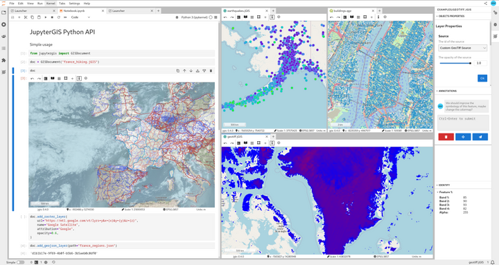
Summary
The article discusses the advancements of the JupyterGIS platform, which is a powerful open-source tool for geospatial data analysis and visualization. It highlights how JupyterGIS has evolved to become a more user-friendly and feature-rich solution, making it easier for researchers and analysts to work with complex geospatial data.
114
28
Summary
eo4society.esa.int